ARTWEB AUCKLAND I


Under the Radar I uses the GIS program ArcMap to discover specific locations for design interventions. Maps of particular data sets are superimposed, and where the richest interaction between sets occurs, a lizard ‘intensity’ is identified. The site’s geologic and vegetative structure and its cultural/social conditions are then analyzed. Design operations extrapolated from the specific conditions of each site are used to develop interventions. The data sets include:
Lizard populations (because there are no maps of these, a vegetation surrogate was used).
Volcanic rocks (of which there are several types).
Cycleways and walkways (a network stretches across the Auckland region).
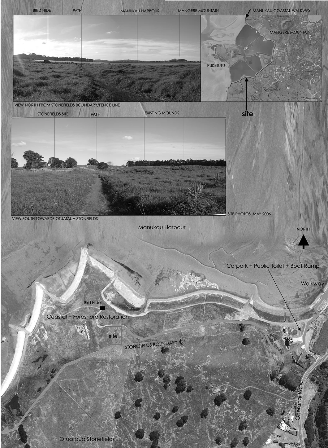
The interventions are ‘lizard gardens,’ enhanced lizard habitat structures that encourage, support and maintain lizard populations by providing the ecological niches, comprising volcanic rocks, leaf litter and plant species, that form lizard habitat. These new landscapes are attractive to humans too. They provide interestingly designed green areas (right in the middle of cities) where visitors can encounter and interact with beings that are often barely registered by the public at large. Intensities have been discovered at a number of locations. The lizard garden depicted here is located at the Otuataua Stonefields on the shore of the Manukau Harbour in Mangere, Auckland, New Zealand. This is the site of ancient Māori sweet potato gardens.
Under the Radar I (2005) was developed in collaboration with Bradbury McKegg Landscape Architects, herpetologist Dr Graham Ussher and field ecologist Leslie Haines. Images - Scott Greenhalgh.